

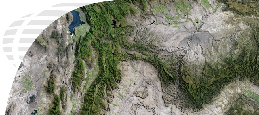


Natural Color Aerial Photography
Digital Data Services, Inc.’s Natural Color Aerial Photography products are recent aerial images for the continental United States that range from 2005-present day. Typically these photographs are within one to two meter resolution (one pixel on the image represents one or two meters on the ground). The products are available in custom areas (user defined areas) and as a county-wide mosaic. For custom areas, you may specify any projection, datum, units, and file format. For county mosaics, the data is delivered as Mr.SID files in the UTM, NAD 83, Native Zone, meters.
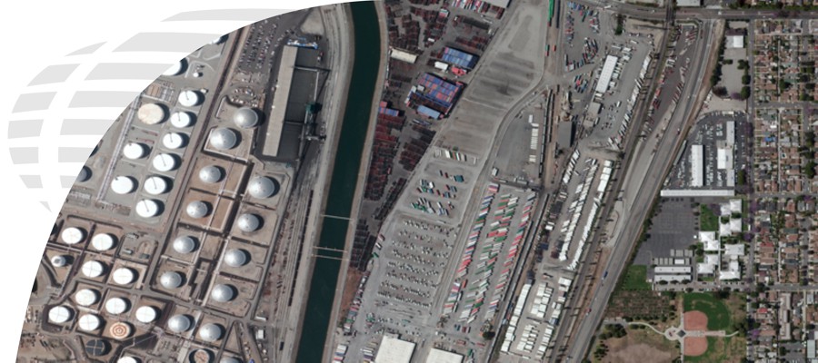
High Resolution Color Aerial Photography
Digital Data Services, Inc.’s High Resolution Color Aerial Photography products are orthorectified aerial photographs for the continental United States (typically urban areas) that range from 2003-present day. These photographs are usually one foot to 3 inch resolution (one pixel on the image represents one foot or 6 inches on the ground). The products are available in custom areas (user defined areas) and you can specify any projection, datum, units and file format.
IKONOS Satellite Imagery
Digital Data Services, Inc., offers DigitalGlobe's IKONOS satellite imagery products.
IKONOS was the world's first commercial satellite able to collect black-and-white (panchromatic) images with 82-centimeter resolution and multispectral imagery with 4-meter resolution. Imagery from both sensors can be merged to create pansharpened 1-meter color imagery . The more than 300 million square kilometers of imagery that IKONOS has collected over every continent is being used for national security, military mapping, air and marine transportation, and by regional and local governments.
To start your search for available IKONOS imagery, select the "Get a Quote for Data" button.
GeoEye-1 Satellite Imagery
Digital Data Services, Inc., offers high resolution satellite imagery through the DigitalGlobe GeoEye-1 satellite imagery products.
GeoEye-1 is equipped with the most sophisticated technology ever used in a commercial satellite system. It offers unprecedented spatial resolution by simultaneously acquiring 0.41-meter panchromatic and 1.65-meter multispectral imagery. Imagery from both sensors on the IKONOS satellite can be merged to create 50 centimeter color imagery (pan-sharpened).
The detail and geospatial accuracy of GeoEye-1 imagery further expands applications for satellite imagery in every commercial and government market sector.
To start your search for available GeoEye-1 imagery, select the "Get a Quote for Data" button.
Historic Aerial Photos
Digital Data Services, Inc. offers millions of high-resolution, historic aerial photographs for the entire United States dating back to the late 1930’s. Historic photography is ideal for environmental engineering, ownership boundary determination, and legal presentations. Utilizing proprietary research tools, our knowledgeable staff will find the best photograph, scale and resolution that best fits your current needs. DDS, Inc. can provide either hard-copy prints or digital files of the photographs, and can also provide the additional service of georeferencing the imagery.
Submitting a Historic Aerial Photo Request
The easiest way to submit an aerial photo request would be through the DDS DataFinderTM application, which is located in the "Get a Quote" tab. Please note that we are searching against millions of records, so specific photo years are helpful along with a brief description of what you are trying to review from the imagery or the intended use. You may also provide us with latitude/longitude coordinates, GIS files, or an address with a buffer (e.g., 1 mile radius from the centerpoint), and we will research availability and scales.