


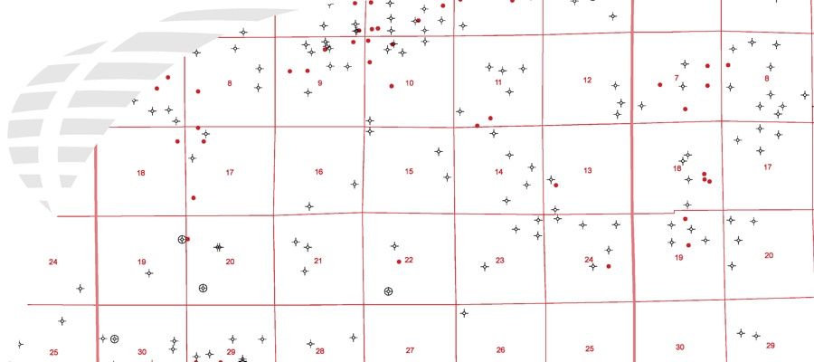

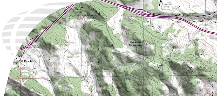


Many organizations that deal with legal descriptions based on Township, Range and Section need to be able to quickly search and locate where the land is spatially. This is why DDS developed a free PLSS Search Utility that enables users to enter the Township, Range, and Section of any given site, and locate that information in an our interactive map.. Not only can users view the Townships and Section Grids, but base layers such as topographic and satellite imagery can be toggled on and off giving users a digitized map that can be exported. DDS also sells the land grid in vector formats, at a nominal price. These base layers can include data from Esri ArcMap (ArcDesktop), Petra, GeoGraphix, AutoCAD, plus many other CAD and GIS applications. All data layers include Township and Section Boundaries. Tabular GIS attributes include Meridian, Township, Range, and Section Numbers.
Article Index
Page 1 of 2